The very first Esri Africa User Conference has shut its doors. And what an incredible experience it was for us all! It’s not every day in Africa that you can walk around with over 900 people that actually know about GIS 🙂 I think the best way to sum up the success of the conference is to look at how our colleagues from Esri Inc were taken aback by the enthusiasm, participation and general level of interest in the technology and the science of GIS. Well done to all those who participated and for all the hard work that the organisers put into the event. I have asked my colleagues to help me put together our Top 7 observations from the conference.
1. Education
This was so popular that we had to turn people away from the dedicated Education track due to lack of space! A number of people I spoke to singled out Michael Goodchild’s keynote about GIS as a science as one of the most interesting talks of the week – what an honour it was to see the ‘informal chat’ he had with Mr Dangermond and Michael Gould of Esri. And there was also significant interest at the Education stand in the Expo centre that was promoting the Funda Lula initiative as well the new upcoming Diploma in Geographical Information Science and Technology (GISc & T).
2. App speed dating
Having been an extremely popular item at the User Conference in San Diego this year, Esri South Africa decided to show of our own talents with a uniquely African twist. All for a serious purpose too – understanding the (very wide) range of apps that run on the ArcGIS Platform and what they are geared to do. The video will certainly be played out in our own offices a few times in the years to come! Well done to the ‘apps’ for putting on a great show.
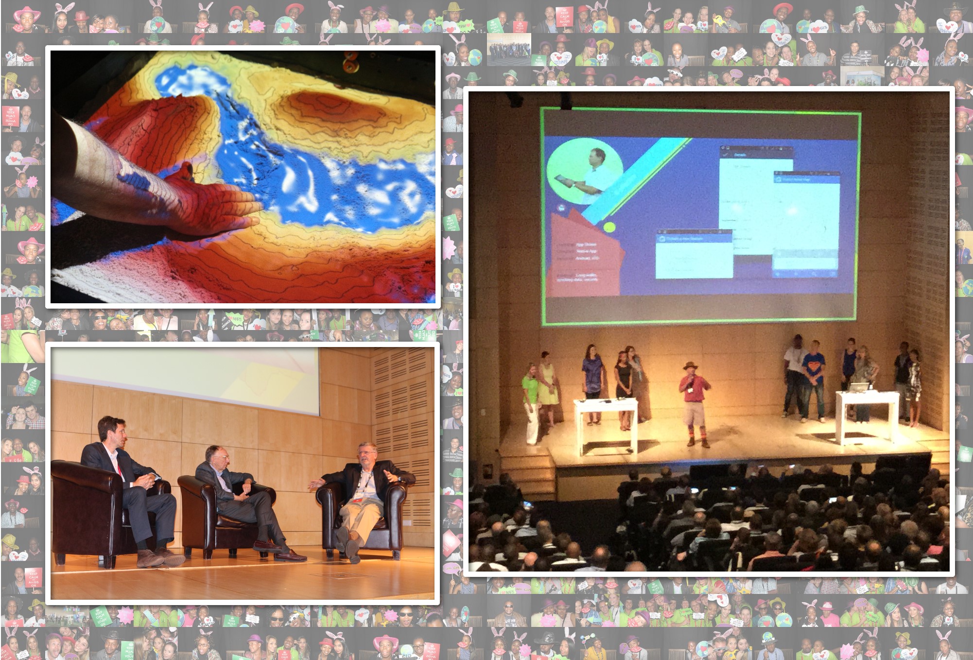
3. Sandbox and 3D printer
People are always interested in toys… While the software demo stands were busy throughout the Expo, it was the educational sandbox and 3D printer that were drawing the most unexpected crowds. If you missed it, the Sandbox is an interactive teaching tool that dynamically projects a contour map onto a box full of sand as you move it around. I saw some new and interesting types of topography being sculpted in there all week! The 3D printer was used for many fun things, but also showing how to turn an abstract map of something like a volcano, into a real, tangible object that you can interact with… Very exciting what we will be doing with this technology in the next few years.
4. Imagery
A sometimes overlooked strength of the ArcGIS Platform is working with imagery. Lots of imagery. Some exciting topics that were covered by Peter Bekker in the Plenary that looked at how you can quickly (!) and easily access petabytes of Landsat data from your basic web browser. You can dynamically adjust the data to show change over time or calculate an NDVI. For more information, have a look at Esri Imagery Services.
5. Free the data
A common area of discussion we had with a number of the delegates was our old friend “data”. Something that came up a few times is how can they engage the public to provide more data – that is, allow the public or clients become active participants in the processes of government and private sector service providers. This is commonly referred to as crowd-sourcing and there are a number of ways of enabling this through the rich apps provided by the ArcGIS Platform (e.g. Survey1-2-3, Collector, etc.). But remember that the tools are only the final piece of the puzzle – first you need to design how this will fit in with your current business processes, who will be the owner of the data, how will it be managed, etc.
The flip side of this coin, is that organisations holding data want to be able to share it more effectively – both with each other – and back to the public. This certainly means that the ArcGIS Open Data initiative is something that will be growing rapidly on Africa in the coming years. For more info, go to ArcGIS Open Data.
6. People!
The final item on our list was… You! I have never seen a closing session quite so full before – this showed to me that everyone (despite their best efforts at the party on Thursday) was keen to squeeze every last drop they could out of the conference. All the technical workshops and training sessions were full; all the paper presentations I went to were very well attended. It was also great to have a good representation from our friends and colleagues in other parts of Africa – I enjoyed some talks about natural resource management in central Africa – and even managed to introduce two experts that are working on the same topic in the same region!
7. Doing it all over again?
Finally, Mr. Dangermond did a pretty good job in helping us decide whether we would be doing this again. Based on some pretty enthusiastic responses from the crowd at the closing plenary, it looks very likely that we will do this all again in 2 years’ time – but nothing is confirmed just yet! The crowd ‘noise-o-meter’ was a little more difficult to read when Jack asked where it should be hosted… but seemed like Cape Town edged it to me? Or was it Durban?
Also, for those of you who would like to review any of the presentations or watch videos of the plenary sessions, they will be made available soon – check back here for details!
– Richard