FIFA World Cup 2018 Stadium Guide – Russia
The background story…
The motivation to create this story map series application is sourced from my true love for soccer (or as some like to call it, ‘football’). I have always watched and loved soccer, and have a key interest for the English, Spanish, German, and South African leagues.
After following the 2017 FIFA Confederations Cup, which was hosted in Russia, I was interested in how the different host stadiums looked, and where they are located. This interest comes from my GIS (Geographical Information Systems) background – and now to fuse my two passions together, this was an exciting activity for me to complete.

How I like to see the world…
The goal…
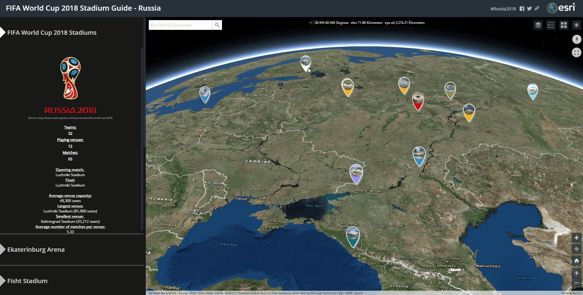
The purpose of the ‘FIFA World Cup 2018 Stadium Guide’ application is for the public to be able to get thorough insights about each of the host stadiums, see how they look, obtain game fixtures, and explore each of the surrounding host stadium’s locations.
The method…
Firstly, I had to collect spatial and attribute information from the Internet, via various sources, to have enough of a foundation to create the source dataset, including the locations and information for each stadium.
The next step which I followed was to create customized (3D looking) stadium icons with Adobe Photoshop, as I wanted to include a picture of each stadium in the location markers for better effect.
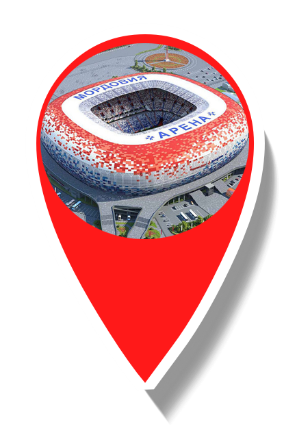
An example of the customized location marker icon for Mordovia Stadium
Once this process was complete, the stadium dataset had to be created, packaged, published to the web, hosted and ultimately be processed so that it could be used in the ‘FIFA World Cup 2018 Stadium Guide’ application.
I used a variety of Esri’s ArcGIS products to create this story map series application, namely:
ArcGIS Pro (Desktop)
This is where the file geodatabase, which included all the stadium locations and attribute data was created. Additionally, I created the 3D multipatches as well using ArcGIS Pro, for those stadiums which I could get existing 3D models. ArcGIS Pro was also used to create scene layer packages of the source data, which could be hosted in ArcGIS Online for the application.
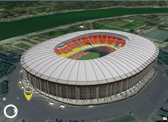
The 3D model used for the Luzhniki Stadium
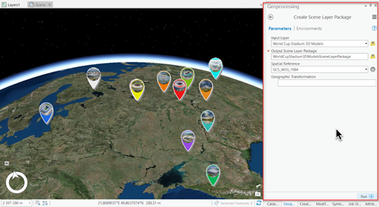
Creating a scene layer package in ArcGIS Pro
ArcGIS Online
This is where I could use the hosted scene layer packages as input for web scenes, and then link these web scenes to the story map series template, to ultimately create the application. This application is hosted on ArcGIS Online.
Esri’s ArcGIS products give the user a great amount of flexibility, interoperability and a variety of configurations which can be altered to create a unique application. ArcGIS Online allows for the user to be able to host, author, and share one’s data, web maps, web scenes, and applications on the web.
The next step…
The future for this application would be to link it to a related application, depicting up-to-date progress, results, and news of the FIFA World Cup 2018.
You can access the FIFA World Cup 2018 Stadium Guide – Russia by clicking here.