![]()
OSM – a valuable source of free geographic information
OSM (OpenStreetMap) is free data that is compiled by a community of mappers from all over the world. The mappers contribute and maintain road data, trails, points of interest and much more. OSM emphasises local knowledge and contributors use GPS devices, aerial imagery and field maps to verify the data and ensure that it is up to date.
OSM is open data and free for you to use for any purpose as long as you credit OSM and the contributors. If you change or build on the data in certain ways you may also distribute the result ONLY under the same license. For more information on the latter refer to the Copyright and License page.
Esri South Africa has processed the OSM data to a file geodatabase for all clients that are current on maintenance, free of charge. Additionally a Community Basemap for South Africa was created using the Esri Inc. template. This is also available free of charge as part of the Portal for ArcGIS offering to clients that are current on maintenance. Clients who are interested in the OSM Community Basemap can contact Esri South Africa. The screen print below shows a clip of the OSM Community Basemap for South Africa.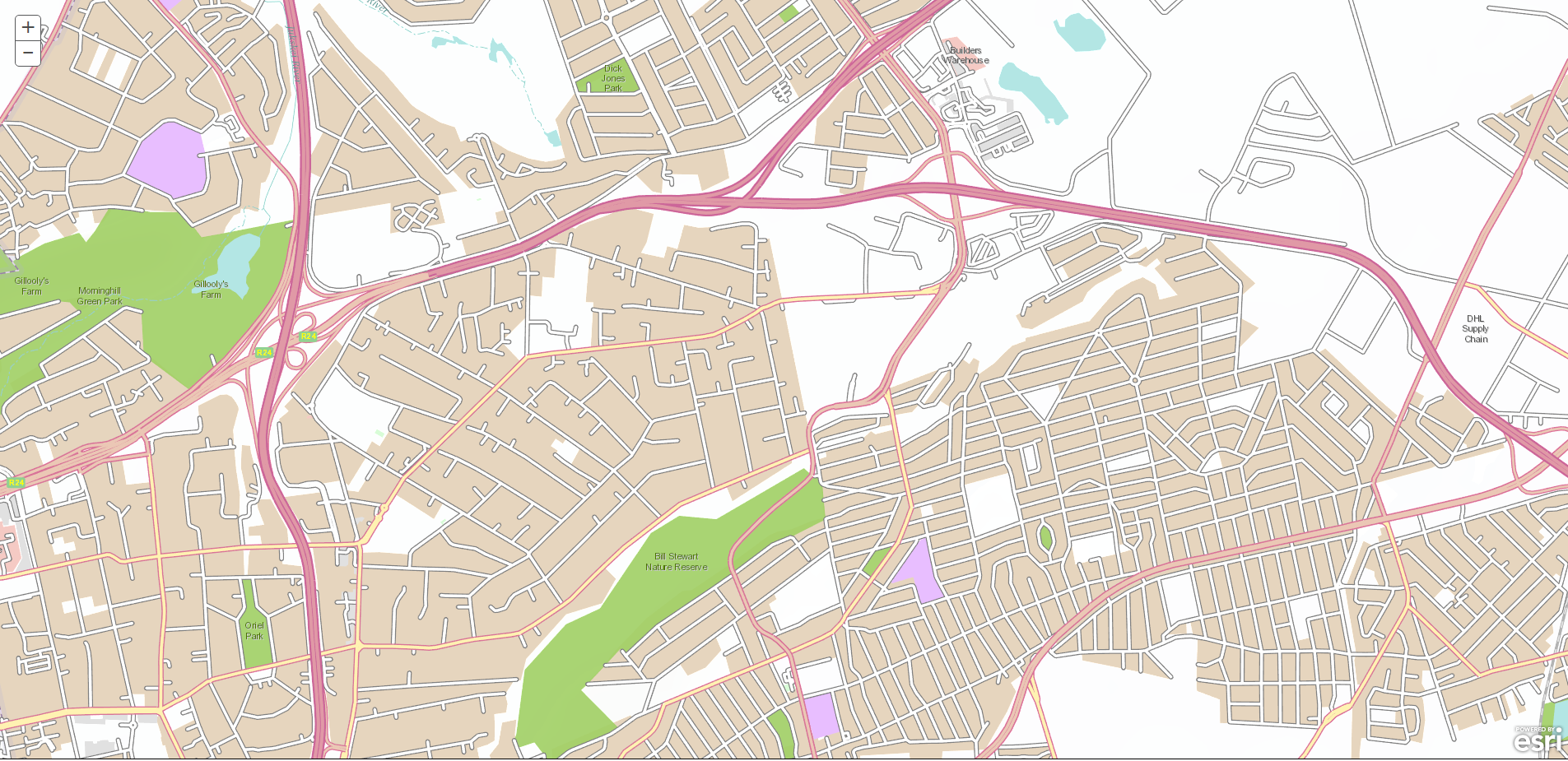
Finding and downloading OSM data for your country or area can be tricky. If your maintenance is not up to date and you wish to download the raw OSM data, the steps below will help you achieve this. The OSM data is available can be downloaded from the OSM website https://www.openstreetmap.org/#map=5/-17.099/51.021 by clicking on the Export Button and selecting one of the options listed.

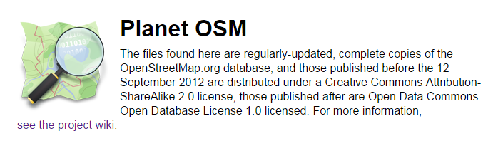
Click on the Planet OSM link which will take you to a webpage with some more options.
To download the OSM data in shapefile format click on the BBBike.org link. This takes you to http://download.bbbike.org/osm/. Click on “Select your own region” as shown below.
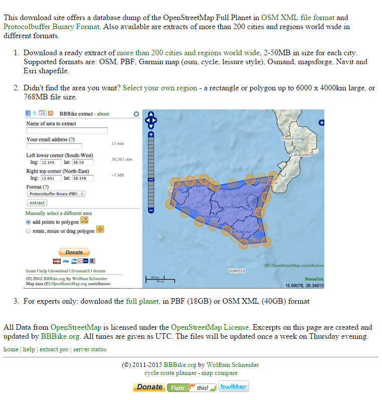
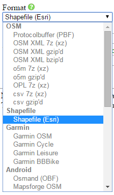
From this page you are able to select and download the data. Specify in which format you want to download the data, select Shapefile (Esri) from the dropdown menu. Enter your email address and complete the Province, Town, or Country name of the area that you want to download and click on the “search” option.
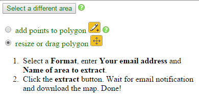
After clicking on the “or search” option you can select the area form the list provided or you can zoom in to the area that you want to download and click “here” to create a bounding box. To add extra points to the bounding box polygon click on the add points icon. You can also resize and reposition the bounding box.
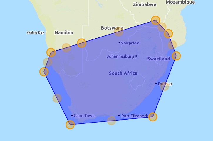
As an example I have selected South Africa and included extra points on the bounding box to make a better selection.
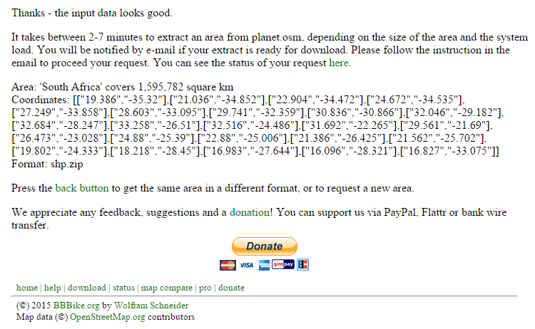
Once you are satisfied with the area that you selected you can click on the “extract” button.
![]()
A pop up message will confirm that the area that you selected is acceptable and will contain information on the size of area, coordinates and format.
You will receive a confirmation email via the email address that you supplied. Click on the download link to download the zip file. The zip file will contain a “shape” folder containing the shapefiles. You can now convert the shapefiles to feature classes for optimal storage in ArcGIS.
If you require more information you can visit the OpenStreetmaps website https://www.openstreetmap.org/#map=5/-17.099/51.021 or OpenStreetMap Facebook page. https://www.facebook.com/OpenStreetMap?fref=ts