As part of our Modelling Reality in 3D series, this post looks at the Esri Africa User Conference demonstration of CCTV camera placement in 3D.
![]()
A prominent United Nations study notes that the share of Africans living in urban areas is projected to grow from almost 40% in 2010 to over 60% by 2050. With the expected rate of population growth on the continent. This increase in urbanisation can lead to economic growth, transformation, and poverty reduction. However, without proper planning the possibility of increased inequality, urban poverty and associated crime exists.
One of the areas to address is crime and this needs to be done in a more systematic way. Applying geography will help us do that.
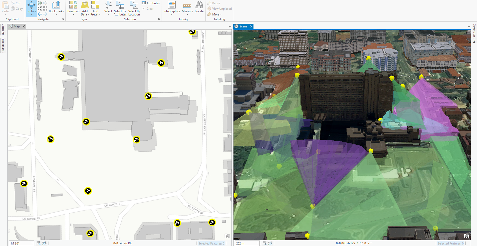
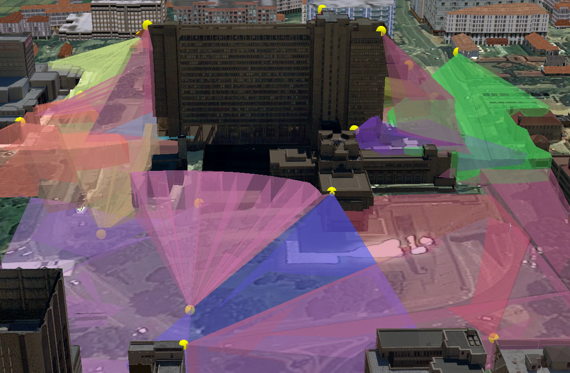
The aim of the demonstration was to show the location and coverage of CCTV cameras in downtown Johannesburg. The objective was to find the optimal coverage area in 3D by altering some of the camera attributes such as angle, direction and length. CityEngine was used to create the CCTV coverage rules, and ArcGIS Pro’s analysis abilities were utilised to determine the covered areas.
CityEngine:
Attributes
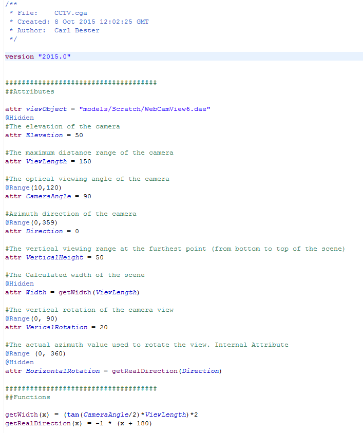
The getRealDirection function converts the azimuth attribute (N= 0, E = 90, S = 180, W = 270) so that the coverage area has the correct real-world direction. See how altering these attributes effects the coverage areas in the video below.
Rules
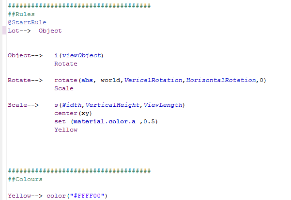
The image below show the rules used to generate the viewing area:
- Object: The Object rule uses the i-function to transform the CCTV point to an existing triangular Collada shape and then calls the Rotate rule.
- Rotate: The rotate function uses the VerticalRotation and HorizontalRotation attributes to change the angle of the viewing area, before calling the Scale rule.
- Scale: Finally the s function scales the viewing area according to the Width, VerticalHeight and ViewLength attributes. The rule then centres, colours and changes the transparency of the 3D viewing area.
ArcGIS Pro
The second part of the presentation showed how these CityEngine rules can be implemented in ArcGIS Pro for further analysis. Some of the analytical capabilities of ArcGIS Pro are listed below
- Display the 3D view areas alongside existing 3D content (such as buildings) in ArcGIS Pro.
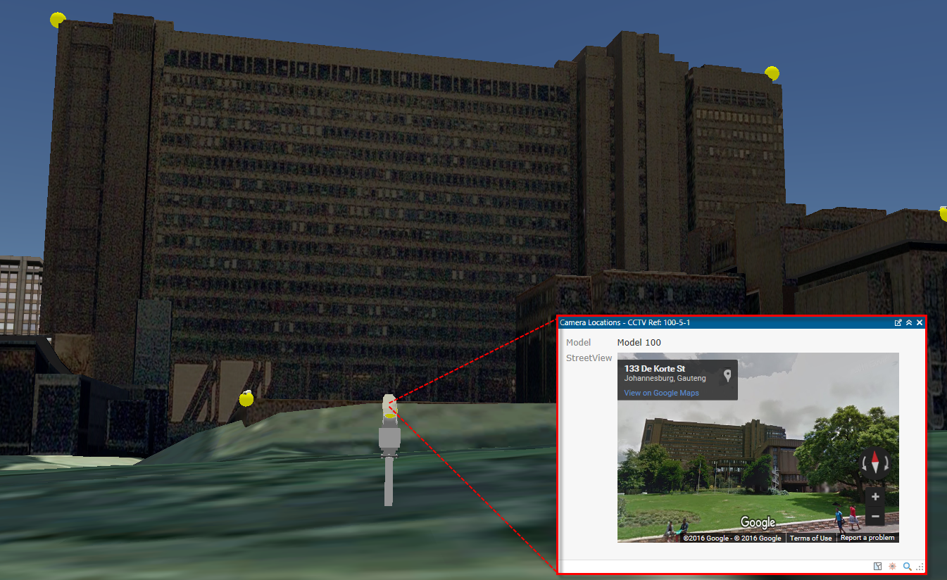
- View feature information in a pop-up. This can include attributes, pictures, videos or HTML attributes such as an i-frame of the Google Street View.
- Calculate the % of the area covered by the cameras. The image below shows the Before and After scenes after additional cameras (blue spheres) were added. We can analyse the coverage of the new additions and compare the calculated values to the previous scenario.
