MAPSS Fire Monitoring and Management Solution
Who is M.A.P Scientific Services?
We are a bolt-on scientific team that uses technology, data analytics, research, and fieldwork to develop customised solutions for conservation, restoration, and sustainable development projects. MAPSS solutions lead to better, faster, and more effective decisions.
The Goal
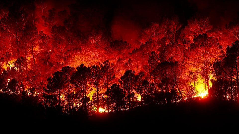
Fire is an integral part of the South African landscape and uncontrolled wild fires pose a risk to life, property, and the environment. More than 40 000 fires are reported in South Africa yearly, which translates to almost R4-billion in annual financial losses. To mitigate fire associated risks, detailed spatio-temporal data is needed to detect, monitor, and predict wildfires. Moreover, it is important to determine the extent of fire damage across regions, and on individual properties, to instruct civil cases and insurance claims from wildfire related damage.
The Challenge
In the Free State province, nearly 260 000 ha is destroyed by fires annually, while unofficial surveys indicate that the province has the highest percentage of civil cases stemming from damage caused by wildfires in the country. The Free State Umbrella Fire Protection Agency (FSUFPA) aims to promote the protection of life, assets, and landscapes from wildfires and promote an efficient system that supports landowners in mitigating fire risk and assessing fire damage. However, to do so effectively requires information on when and where fires occur, and how much damage they cause.
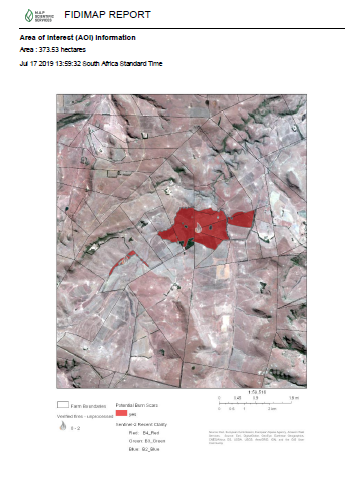
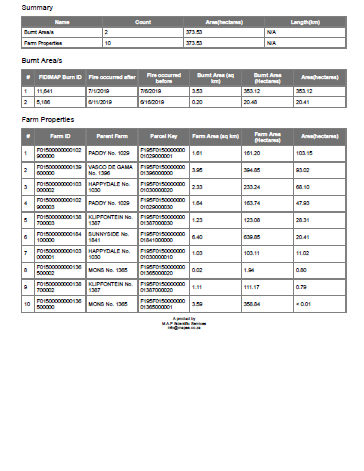
The Solution
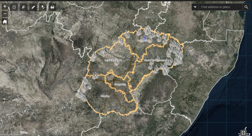
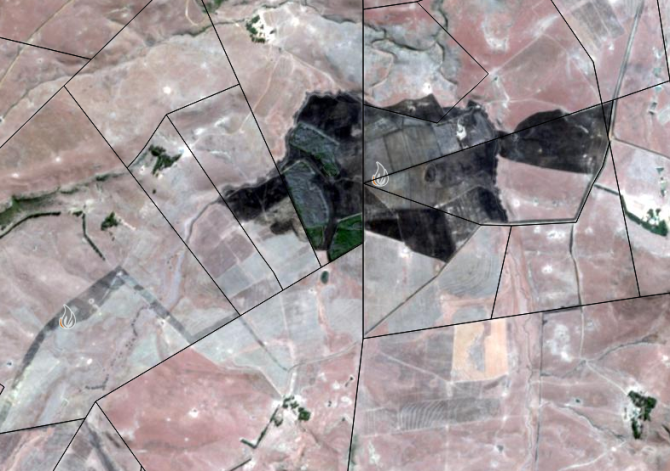
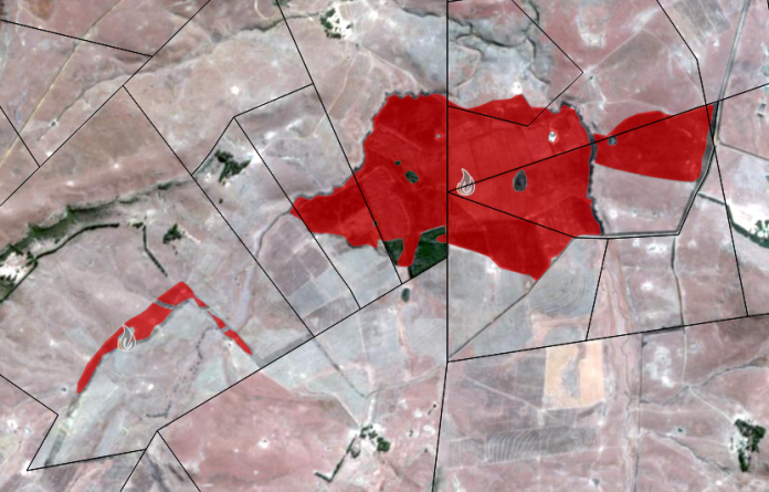
The solution utilises multiple sources of high resolution satellite imagery to display fire occurrence and calculate fire extent on a dynamic and spatially explicit platform. Fire occurrence is updated in near real-time, while the extent (area burnt) of each fire is mapped and calculated at five day intervals. Moreover, the area burnt per private property (i.e. farms) is automatically calculated and summarised with additional information associated with each fire. The solution allows FSUFPA to organise timely responses to fires, identify illegal fires, and better manage the risk of fires close to high value infrastructure and property. It also provides individual landowners with the relevant information to support insurance claims and civil cases related to fire damage on private properties.
Click on the image below to view the Gallery:

The Challenge
– Uncontrolled wildfires pose a serious threat to life, property and the environment.
– To mitigate fire associated risks, detailed spatio-temporal data is needed to predict, detect, and monitor wildfires, as well as instruct civil cases stemming from wildfire related damage.
The Solution
– A spatially explicit monitoring platform where fire occurrence is updated in near real-time, and fire extent (area burnt) per private property is calculated every five days.
The Benefits
– Allows fire protection associations to organise timely responses to fires, identify illegal fires, and better manage the risk of fires close to high value infrastructure and property.
– Provides individual landowners with information (i.e. area burnt per farm) to support insurance claims and civil cases related to fire damage on private properties.